Light Pollution Science and Technology Institute

Istituto di Scienza e Tecnologia dell'Inquinamento Luminoso

Light Pollution Science and Technology Institute

The night sky in the World Home Page
How we surveil the situation of the night sky with satellites
The DMSP satellite and its Operational Linescan System
The World Atlas of sea level artificial night sky brightness
Maps of the artificial night sky brightness
Maps of the total night sky brightness
Maps of the naked eye stellar visibility
Maps of the number of visible stars
Maps of the growth of light pollution
Maps of the night sky in selected sites
Our scientific papers
Our group of study
Light Pollution in Italy Web Site
Dep. of Astronomy University of Padova

National Geophysical Data Center - DMSP Nighttime Lights of the World

International Dark-Sky Association - DMSP nighttime  images

NASA - DMSP pages

Earth View

The night sky live


Copyright 2000, P. Cinzano, Thiene, Italy

 All rights reserved


The night sky in the World

Satellite monitoring of the artificial night sky brightness and the stellar visibility


The World Atlas of the Artificial Night Sky Brightness


ma1064fig2

High-resolution zipped TIFF map     2MB  (130MB after unzip)
 

The World


ma1064fig4

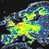
Europe


ma1064fig7

Center Asia


ma1064fig2

North America


ma1064fig5

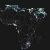
Africa


ma1064fig8

East Asia


ma1064fig3

South America

ma1064fig6

West Asia

ma1064fig9

Oceania


The night sky in the World  Home page